Day 5 we drove up to the Many Glacier area of the park (about 45 minutes north of the St. Mary area). We did not get to visit the Two Medicine area, or the northern lakes on this trip - have to go back someday...
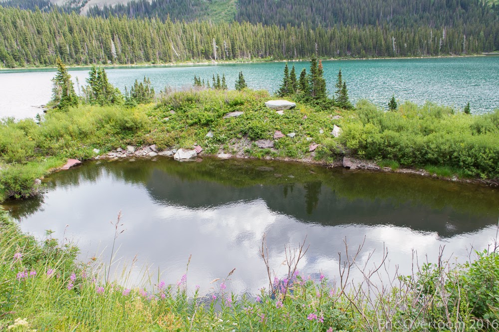
Many Glacier is home to several smaller lakes, along with a number of hikes to glaciers and is a jumping-off point for the northern part of the backcountry in the park. At the entrance the reflective view up Sherburne Lake called for a stop and pictures.
 |
| Sherburne Lake |
Our goal was to hike to Grinnell Lake, which receives water from Grinnell Glacier on the east side of the Garden Wall rock formation. There is a boat tour which heads along two lakes to make a remaining 1 mile hike to the lake, we hadn't reserved spots on a boat so chose to start from the trailhead and hike along Swiftcurrent Lake and Josephine Lake, making a total round trip of about 7.5 miles.
On the outbound trip, we saw a doe feeding on the flowers alongside the trail, she stepped off the trail about 10 feet to get around us and continued in the opposite direction. The trail started along a creek, then followed the lakes before joining and following Grinnell Creek. There was a suspension bridge crossing the creek which added a little excitement to the hike.
Lunch was at lower Grinnell Lake, seeing the falls at the far end of the trail. There is another trail that heads to the upper lake, and has a view of the glacier - but is about 4 miles longer round trip, with some elevation gain. We saw another doe wading in the lake. We didn't stay too long - mosquitoes were pretty bad, and clouds were starting to come in (in fact, it started raining about 5 minutes after we reached the car).
On the return trip, we decided to hike the other side of the lakes, to see something a little different on the return trip. Once we reached the boat dock, the disembarking passengers told us about a moose in the water near the boat dock, so we saw him for a bit.
After about 1/4 mile of walking we came upon Momma Moose and her calf, eating trees on and along the trail. I didn't get a good picture of them, but did get a picture of the prints in the trail. We eventually turned around and returned on the other side of the lake when it was obvious that the moose weren't going to move for us. There was a group of hikers on the other side of the moose, who were looking at a much longer way around if the moose didn't move on soon...
Not much happened on the way back to the car - other than clouds starting to gather. On return to the trailhead parking lot we found 2 more moose eating the grass alongside the road - about 20 feet from the car.
Our last day in the park we wanted to go up to Logan Pass and do some hiking - but the day was a bit colder and much cloudier - we saw clouds over the tops of the mountains, and the pass was quite chilly. At the pass we had two choices - a short hike to see Hidden Lake (the trail to the lake was closed for fish spawning), or we could hike some portion of the Highline Trail. We ended up hiking the Highline Trail from Logan pass to the Loop trailhead down the road - 11.5 miles total hiking with mostly an elevation drop - the kids did awesomely the whole way. We then caught a shuttle back up to Logan Pass, and then a shuttle back to St. Mary Visitor Center.
 |
| Highline trail hike |
 |
| Highline trail elevation profile |
We enjoyed lunch near Haystack Butte, an afternoon break at the Granite Park Chalet, seeing Marmots, another doe, and some fantastic views into the valleys. If you look at the map above you can see we actually were pretty close to the previous days hike - the Highline trail runs along the east side of the Garden Wall, and has a spur trail to an overlook of Grinnell Glacier. The start of the Highline trail is carved out of the rock wall, with a drop to the road below. After the chalet the last 4 miles is all downhill, dropping 3000 feet.
 |
| Cloudy at Logan Pass |
 |
| The carved portion of the trail |
 |
| Look - snow! |
 |
| Marmot! |
 |
| Bear Grass bloom |
 |
| At Granite Park Chalet |
 |
| Huckleberries! |
 |
| Waiting for the shuttle - windy and chilly at Logan Pass |
Over 30 miles of hiking in all - lots of great scenery, but we barely scratched the surface of this park. We'll have to return at some point for Two Medicine, Kintla and Bowman Lakes, and the southern parts of the park.
We saw lots of deer, lots of marmots, 5 moose, no bears.